The last supermoon of the year, popularly known as the Beaver Moon, shone brightly in the clear sky overnight. It is known as the beaver moon because this is the time of year when beavers begin to hunker down in their shelters and hoard food in preparation for the winter.
The beavers are onto something because temperatures are frigid and will continue to drop overnight, dropping back into the 50s and 40s by Saturday morning. Although Saturday morning will be cool, the afternoon will quickly warm up, with temperatures reaching the 70s.
Though the quiet weather has been pleasant, a large upper-level low-pressure system will move over the region in the following days, bringing a more unsettled weather pattern. Sunday afternoon is likely to bring isolated thunderstorms and widespread showers.

However, the likelihood of severe weather will not be high until late Sunday night or early Monday morning.
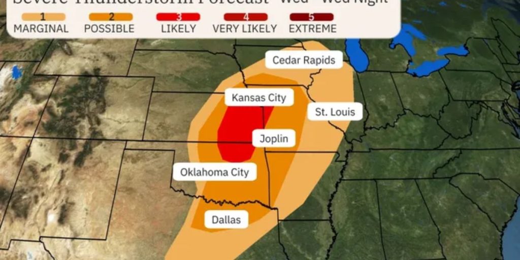
The Storm Prediction Center has issued a level 2 out of 5 warning for severe thunderstorms, with hail, destructive gusts, and perhaps an isolated tornado likely. The threat will continue to drift east into Monday, affecting the early morning I-35 traffic.
By Monday evening, conditions will improve for a fantastic night, followed by a lovely Tuesday.
However, by Wednesday, another powerful front will bring a chilly snap, with highs barely in the upper 50s. Stay tuned for the newest updates!


