
SARASOTA, Fla. — This week’s weather forecast in Sarasota calls for a series of cold fronts that will not only bring a slight dip in temperatures but also a chance for much-needed rainfall. As the weather shifts, residents can expect to see fluctuating temperatures, increasing humidity, and the potential for showers and thunderstorms, especially towards the end of the week.
Warmer, More Humid Days Ahead
Today, Sarasota will see a slight warm-up compared to the previous day. Afternoon temperatures will climb into the upper 70s, which is about 3 to 5 degrees above the usual for this time of year. Along with the warm-up, expect a bit more humidity in the air, especially in the afternoon. Despite the humidity, there will still be plenty of sunshine throughout the day to keep things pleasant for outdoor activities.
For those affected by red tide irritants in the air, an offshore wind blowing from the east may offer some temporary relief in the morning. However, as the wind shifts to a westerly direction later in the afternoon and into the evening, respiratory irritation from red tide could increase. Those sensitive to the condition should keep this in mind as the weather changes.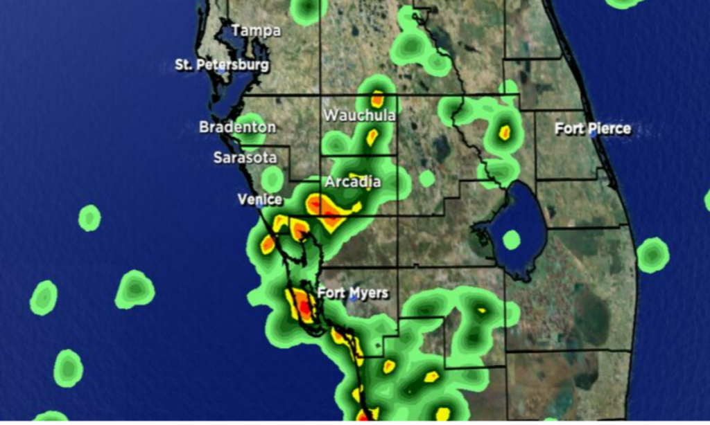
Cold Fronts and Rain in the Forecast
The first cold front of the week will arrive tomorrow evening, bringing with it a chance for rain. Late in the day, as you make your way home, expect a line of showers and thunderstorms to begin moving through Florida. These showers will first hit the region in the morning but will weaken as they move closer to Sarasota in the late afternoon. While the rain isn’t expected to be heavy, areas that do experience showers may see between 0.25 to 0.5 inches of rainfall, which could be a welcome relief for those in need of rain.
As the front moves through, cooler air will follow. This will bring a noticeable drop in temperatures, with highs likely falling below the normal range for the first time in several weeks. The cooler weather will stick around into Thursday, providing a refreshing break from the warmer days.
Weekend Outlook: Another Cold Front Approaches
Looking ahead to the weekend, another cold front is expected to approach Sarasota on Sunday. This system will be positioned slightly further south, developing over Gulf waters. As it moves into the area, there is a higher chance for rain, with the possibility of stronger showers as the front passes through. Residents can expect more rainfall, which will continue to help relieve the dry conditions in the area.
What This Means for Sarasota
The weather this week will bring a mix of sunshine, humidity, and rain. While the drop in temperature will be a welcome change for some, the rain will be the main story, as it is expected to provide some much-needed moisture to the region. Those who are sensitive to red tide should stay aware of how the wind shifts, as it could lead to an increase in irritation from the algae bloom. Additionally, the rain from the cold fronts will offer a chance to water the landscape, which has been dry in recent weeks.
Whether you’re planning to enjoy the sunny weather today or preparing for the cooler, wetter days ahead, make sure to stay updated on the weather forecast and be prepared for any changes. As always, it’s a good idea to keep an umbrella handy, especially if you’ll be out in the evening when the rain chances are higher.
Disclaimer—Our team has checked this article to ensure its accuracy and eliminate any misinformation. We are committed to providing clear and reliable information for our readers.