A significant winter storm is set to impact the Midwest and Southeast regions of the United States, bringing heavy snowfall and dangerously cold temperatures from Monday, February 17, through Wednesday, February 19, 2025. The National Weather Service (NWS) has issued a Winter Storm Watch for several states, including Illinois, Indiana, Kentucky, and Missouri, warning residents of potential hazardous conditions.
Forecasted Conditions
Meteorologists predict substantial snowfall accumulation, with totals ranging from 4 to 9 inches in affected areas. The storm is expected to begin late Monday night and continue through Wednesday morning, impacting daily activities and travel plans.
Regional Impacts
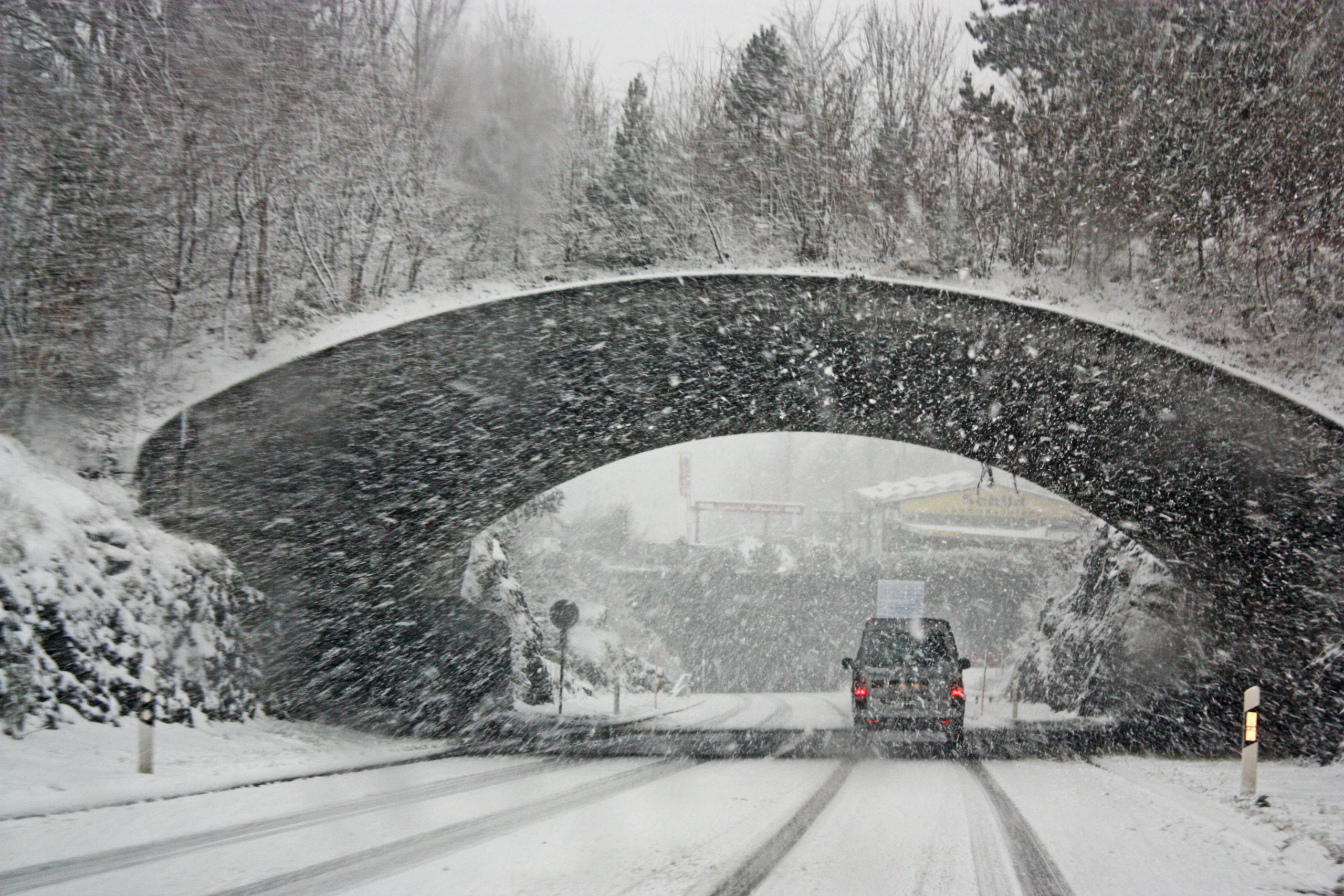
- Southern Illinois: Areas such as Carbondale are forecasted to experience very cold temperatures with increasing clouds on Monday, followed by snow and flurries on Tuesday, accumulating 1-3 cm. Wednesday is expected to be cloudy, brisk, and very cold with a little snow, mainly early, bringing a storm total of 3-6 cm. Dangerous travel conditions are anticipated, especially on bridges and overpasses.
- Southwest Indiana: In cities like Evansville, the forecast includes very cold conditions with some sun on Monday, increasing clouds, and an impactful winter storm bringing disruptive snow later in the week. Snow and flurries are expected on Tuesday, accumulating a coating to 1 cm, with a storm total snowfall of 3-6 cm by Wednesday. Untreated surfaces will be slippery, and hazardous travel conditions are expected.
- Western Kentucky: Paducah is expected to experience cold conditions with sunshine on Monday, followed by cloudy and very cold conditions on Tuesday, with a coating to a cm of snow late in the afternoon. Wednesday is expected to be very cold with snow and flurries at times in the morning, bringing a storm total of 6-12 cm. Dangerous travel conditions are anticipated, especially on bridges and overpasses.
- Southeast Missouri: Cape Girardeau is forecasted to experience mostly sunny and cold conditions on Monday, followed by cloudy, brisk, and colder conditions on Tuesday, with a cm or two of snow late in the afternoon. Wednesday is expected to be snowy with flurries at times in the morning, bringing a storm total of 6-12 cm. Dangerous travel conditions are expected, especially on bridges and overpasses.
Safety Precautions
The NWS advises residents to monitor the latest forecasts and updates on this situation. Travel should be delayed if possible. If travel is absolutely necessary, drive with extreme caution and be prepared for sudden changes in visibility. Ensure your vehicle is winterized and in good working order, and keep an emergency kit with essentials such as blankets, food, and water.
Conclusion
This winter storm presents significant challenges for the affected regions, with heavy snowfall and extreme cold temperatures expected to cause hazardous conditions. Residents are urged to stay informed through official channels and take necessary precautions to ensure their safety during this severe weather event.
(Source : countyobserver.com)